Main Info
The Inca Trail is the most famous route, with the most dreamed destination to visit the citadel of Machupicchu. Once you start the hike you will realize that it is not only the physical effort but the enigmatic spirit that will motivate you to discover.
| Departure | San Diego International Airport |
| Departure Time | Please arrive by 10:20 AM for a prompt departure at 10:50 AM |
| Return Time | Approximately 8:30 PM |
| Included |
|
| Excluded |
|
Itinerary
Piscakucho or Km. 82 approximately 2.00 hrs. of trip then we begin the trekking following the vilcanota river to then ascend to the community of Miskay at 2800 m.t.a.s.l. / 9186 ft. and finally see the city of Patallaqta.
We will continue trekking through the valley next to the Kusicancha river ascending little by little for about 5 hrs. until we arrive to the first camp Wuayllabamba at 3000 m.a.s.l. / 988 ft.
On the way we can appreciate beautiful views of the Cordillera Vilcanota and one of the most beautiful snow-capped mountains in the area called the Veronika at 5680 m.a.s.l. / 18640 ft. with an admirable flora and fauna from all angles.
Wayllabamaba Warmi Wañuscca Pacaymayo.
After breakfast we restart the walk the most difficult part but with the good vibes of the place encourages us more and more to want to get to the top of the Inca Trail where we will have one of the most panoramic views of the route and to observe the different ecological floors after 3hrs. of trekking approx. we go through the pass called Warmy waañusqa "dead woman" 4200 m.t.s.n.m. 13779 ft going through the zone of the cloud forest that is the habitat of the spectacled bear, hummingbirds, sparrows, as well as the Andean bear after about 6hrs. of trekking we arrive to our destination.
PACAIMAYO WIÑAIWAYNA.
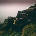
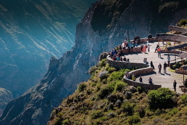
This is one of the longest days but at the same time the most impressive we compensate with the hike to Wiñaiwayna passing by we can visit the archaeological rest Runtu rakay 3970 m.t.s.n.m. 1324 ft. which is a small oval structure that is supposed to have been a watchtower and after a short rest we descend to the lagoon of yanacocha "black lagoon" continuing through the cloud forest we arrive to sayacmarca 3626 m.s.n.m. 11899 ft.
It is a beautiful semi-circular complex with different enclosures i streets, narrow, fountains, liturgical, irrigation canals continuing along the road we arrive to phuyopatamarka 3700 m.a.s.l. 1239 ft. along this route we can appreciate roads separated by rocks that fill the ravines. We will also pass through an Inca tunnel and then arrive at the best preserved complex in the area and at the same time the most complex of the Inca trail of the same name phuyopatamarka which means place above the clouds where there is a sophisticated hydraulic complex with water fountains on solid foundations and you can also see a sacred enclosure and at the same time the most beautiful views of the Urubamaba river valley and after walking down long stairs we will descend to Wiñaiwuayna 2770 m. t.s.n.m. 8858 ft. The complex has numerous terraces and an agricultural center, a religious sector where we will spend the night in our camping site where we can find showers, bathrooms, restaurants and bars.
Wiñaiwuayna Mchupicchu.
El cuarto i ultimo día salimos muy tempano para poder visitar el inti punku o puerta del sol al rededor de una hora a lo largo de este camino fabuloso con piedras planas i con bordes acantilados en esta parte de la selva ver el amanecer para viajar finalmente a nuestro destino Machupicchu donde por un lapso de 2 hrs . podremos disfrutar de la mágica i enigmática ciudadela inca fin de nuestro viaje.
Review ( 1 )